September Water Quality Report – Plus New NYC and Quassaick Creek Data
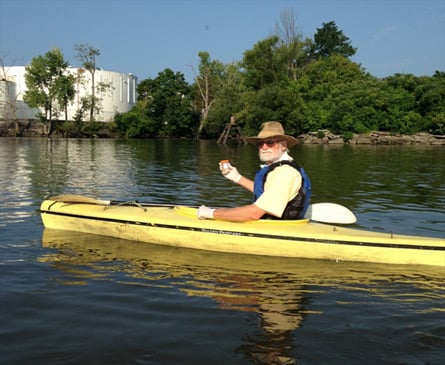
Sampling on the Quassaick Creek in Newburgh. Photo by John Gephards, Quassaick Creek Watershed Alliance
View more images on our Flickr site
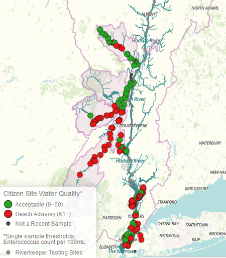
We’re proud to announce that the Citizen Testing Data section at riverkeeper.org now includes data for the New York City waterfront and the Quassaick Creek, which meets the Hudson at Newburgh, thanks to two of our partners, New York City Water Trail Association and the Quassaick Creek Watershed Alliance. Riverkeeper assisted in the design of both groups’ sampling programs, which together account for 53 sampling locations. Unlike our other citizen science projects, which test monthly and use Riverkeeper’s onboard lab, the New York City group samples weekly, the Quassaick Creek group biweekly, and both use third-party labs.
Sampling on the Quassaick Creek in Newburgh. Photo by John Gephards, Quassaick Creek Watershed Alliance
A look at recent data
There has been little rain in the Hudson River watershed in September. As we have come to expect, given the dry weather, test results this month have been relatively good: 87% of our samples in the Hudson River estuary between September 7 and 10 passed the Environmental Protection Agency’s guidelines for safe swimming.
It’s interesting to note that the sites that did fail were almost all at or near tributaries, including the Mohawk River and Patroon Creek in the Capital District, the Indian Kill at Norrie Point, Cedar Pond Brook at Stony Point and the Saw Mill River in Yonkers. We saw low bacterial counts in the tidal portion of other tributaries where there was very little flow entering the river, including the Esopus, Catskill and Rondout creeks.
Note that the results presented here represent a snapshot in time, and are not indicative of water quality today. We encourage the public to explore the historical data as one way to make informed choices about where and when to enter the water.
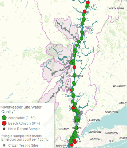
Where citizen scientists are testing the non-tidal portion of tributaries, results after an extended period of dry weather like this may tell us something about the sources of contamination that would be masked by higher flow dispersing or diluting pollution. Where US Geological Survey stream gauges are in place in our tributaries, they show that flows by the end of September were at a fraction of average.
Our tributaries tend to have lower bacterial counts in dry weather, but not all recovered to swimmable water quality in our last round of sampling. On the dates in September we sampled, greater than 80% of sample sites passed in the Catskill and Esopus, but greater than 80% failed in the Pocantico and Wallkill Rivers, and the Sparkill and Rondout Creeks.
In most cases, there will just be one more sample taken at each location this season. While people continue to use the estuary, swimming is less and less frequent as summer turns to fall. The last two big swimming events of the season took place last weekend. In 2014, at least 5,665 swimmers took part in 30 organized swim events in the Hudson River estuary between New York City and Saugerties. The vast majority of those who swim go uncounted.