Enterococcus (“Entero”) is a fecal indicating bacterium that lives in the intestines of humans and other warm-blooded animals.
- Water Quality Program
- Hudson River Estuary Data
- Albany County & Rensselaer County Sites
- Greene County & Columbia County Sites
- Ulster County & Dutchess County Sites
- Beacon Harbor
- Esopus Creek Entrance
- Esopus Creek West
- Kingston Point Beach
- Kingston Sewage Treatment Plant Outfall
- Malden Launch Ramp
- Marlboro Landing
- Norrie Point mid-channel
- Norrie Point Yacht Basin
- Port Ewen Drinking Water Intake
- Poughkeepsie Drinking Water Intake
- Poughkeepsie Launch Ramp
- Rondout Creek- Eddyville Anchorage
- Rondout Creek- Kingston Public Dock
- Tivoli Landing
- Ulster Landing Beach
- Wappingers- New Hamburg
- Orange County & Putnam County Sites
- Rockland County & Westchester County Sites
- Annesville Creek
- Cedar Pond Brook
- Croton Point Beach
- Emeline Beach- Haverstraw
- Furnace Brook
- Haverstraw Bay mid-channel
- Irvington Beach
- Kingsland Point Park- Pocantico River
- Nyack Launch Ramp
- Orangetown Sewage Treatment Plant Outfall
- Ossining Beach
- Peekskill Riverfront Green Park
- Piermont Pier
- Saw Mill River
- Stony Point mid-channel
- Tappan Zee Bridge mid-channel
- Tarrytown Marina
- Upper Sparkill Creek
- Yonkers mid-channel
- Yonkers Sewage Treatment Plant Outfall
- New York City, Hudson County & Bergen County Sites
- 125th St. Pier
- 79th Street midchannel
- Bayridge Flats
- Castle Point, NJ
- Dyckman Street Beach
- East River mid-channel at 23rd Street
- East River mid-channel at Roosevelt Island
- George Washington Bridge mid-channel
- Gowanus Canal
- Harlem River – Willis Ave. Bridge
- Harlem River- Washington Bridge
- Morris Canal
- Newtown Creek- Dutch Kills
- Newtown Creek- Metropolitan Ave. Bridge
- North River Sewage Treatment Plant at 145th
- Pier 96 Kayak Launch
- The Battery mid-channel
- Tributary and Waterfront Data
- Bronx River
- Bronx- Burke Avenue Bridge
- Bronx- River Park at 182nd Street
- Bronxville- Near Grassy Sprain Brook confluence
- Eastchester- Bronx River Parkway at Leewood Drive
- Greenburgh- Greenacres Avenue
- Hunts Point Riverside Park beach & dock
- Mount Pleasant- Highclere Lane
- Mount Pleasant- S Kensico Ave at Pat Henry Field
- Soundview Park- HP-009 CSO outfall
- Soundview Park- Mouth of river
- Soundview- Starlight Park North dock
- White Plains- Westchester County Center
- Yonkers- Bronx R Pkwy between McLean & Wakefield Aves
- Yonkers- Muskrat Cove outfall
- Catskill Creek
- Cairo- Above WWTP outfall
- Cairo- Below WWTP outfall
- Catskill Creek- East End
- Cauterskill- Kaaterskill Creek tributary
- Cauterskill- Rt 23 Bridge swimming hole
- Durham- Dean’s Mill swimming hole & fishing
- Durham- Ten Mile Creek tributary
- East Durham- Route 67/67A swimming hole
- East Durham- Thorp Creek tributary
- Freehold- Basic Creek tributary
- Jefferson Heights- West Main Street
- Leeds- Fire Department intake
- Leeds- Old Stone Bridge outfall
- Leeds- Slippery Rock
- Livingstonville- CCC Camp Road fishing access
- Livingstonville- Route 145
- Livingstonville- Stone Store Road
- Middleburgh- The Vlaie fishing & boating access
- Oak Hill- above Oak Hill
- Oak Hill- Brandow Memorial Park boating access
- Potter Hollow- Route 145/81 fishing access
- Preston Hollow- Cheese Hill Road fishing access
- South Cairo Bridge
- East River
- Bowery Bay- WPCP
- Bronx River- Mouth
- Bronx River- Riverside Park boat launch
- Bronx River- Starlight Park
- East River- Barretto Point Park
- East River- Ferry Point Park
- East River- Fort Totten Park
- East River- Hell Gate Bridge
- East River- Hunts Point WPCP
- East River- Mid-channel A
- East River- Mid-channel B
- East River- Tallman Island WPCP
- East River- Throgs Neck
- East River- Wards Island WPCP
- East River- Whitestone shoreline
- Flushing Bay- Inner Bay mouth
- Flushing Bay- Outer Bay mid-channel
- Flushing Bay- Outer Bay mouth
- Flushing Bay- Pier 1
- Flushing Bay- World’s Fair Marina
- Flushing Creek- Inner
- Flushing Creek- Mouth
- Flushing Creek- Northern Blvd
- Flushing Creek- Whitestone Expressway
- Little Neck Bay- Eastern embayment
- Little Neck Bay- Inner
- Little Neck Bay- Outer
- Luyster Creek- Inner
- Luyster Creek- Mouth
- Westchester Creek- Cross Bronx Expressway
- Westchester Creek- Inner
- Westchester Creek- Mouth
- Westchester Creek- Pugsley Creek
- Esopus Creek
- Esopus Creek Entrance
- Hurley- Route 209 fishing access
- Hurley- Wyncoop Rd Bridge Fire Dept intake
- Kingston- Washington Avenue Bridge
- Lake Katrine- Leggs Mill Bridge
- Lake Katrine- Plattekill Creek tributary
- Lake Katrine- Sawkill Creek tributary
- Lincoln Park- Orlando Park
- Marbletown- Ashokan Reservoir seepage
- Marbletown- Fording Place Road fishing access
- Marbletown- Little Beaver Kill source waters
- Marbletown- Mill Pond swim and boat access
- Marbletown- Tongore Creek tributary
- Marbletown- Tongore Park swimming beach
- Mt Marion- USGS Streamgage
- Saugerties Village Beach
- Saugerties- Cantines Island beach
- Mill Creek
- Mohawk River
- Amsterdam- North Chuctanunda Creek at Forest Ave.
- Amsterdam- North Chuctanunda Creek at Shuttleworth Park
- Amsterdam- Public dock at Riverlink Park
- Amsterdam- Quist Road boat launch
- Canajoharie- DEC boat launch at Route 10
- Charleston- Schoharie Creek at Burtonsville fishing access
- Cohoes- D/S of landfill at New Courtland St.
- Cohoes- Van Schaick Island at Heartt Ave informal access
- Cohoes- Van Schaick Island at Mohawk-Hudson Bike/Hike Trail
- Florida- Lock 10 boat launch
- Florida- Old Erie Lock 28 kayak launch
- Fort Plain- Lock 15 kayak launch
- Frankfort- Dyke Road Bridge
- German Flatts- Barge Canal at Lock 18
- Glen- Riverside Drive kayak access
- Glen- Schoharie Creek at Mohawk Crossing boat launch
- Glenville- Lock 9 boat launch
- Green Island- Silhouette Boathouse
- Halfmoon- I-87 crossing
- Halfmoon- Power line crossing
- Herkimer at I-90 bridge
- Herkimer- Fishing access at STP
- Herkimer- Gems Along the Mohawk kayak launch
- Herkimer- West Canada Creek at Lowe’s
- Ilion boat launch
- Little Falls- Canal Harbor boat launch at Rotary Park
- Manheim- East Canada Creek at Route 5 Bridge
- Middleburgh- Schoharie Creek at Timothy Murphy Park
- Minden- Barge Canal at Lock 16
- Niskayuna- Aqueduct Park rowing docks
- Niskayuna- Lock 7 boat launch
- Oriskany- Oriskany Creek tributary
- Rome- Barge Canal at city boat ramp
- Rome- Bellamy Harbor Park
- Rome- Delta Lake outlet
- Rotterdam- Lock 8
- Schenectady STP
- Schenectady- Mohawk Harbor
- Schuyler- Frankfort Harbor
- Schuyler- Moyers Creek tributary
- Utica- Barge Canal at Historic Utica Marina
- Utica- Park & Ride fishing access
- Utica- Reall Creek tributary
- Waterford- Flightlocks Road boat launch
- Waterford- Tail Race fishing area
- Whitestown- Route 32 Bridge
- Moordener Kill
- New York City Waterfront
- Alphabet City- East River, Stuyvesant Cove landing
- Astoria- East River, Hallets Cove beach
- Bayside- Little Neck Bay marina
- Bronx River- Hunts Point Riverside Park
- Brooklyn Heights- East River, Brooklyn Br Park, Pier 4 beach
- Brooklyn Heights- East River, Pier 2 kayak dock
- Brooklyn Navy Yard- East River, Wallabout Channel
- Bushwick Inlet Park
- Canarsie- Paerdegat Basin, Sebago Canoe Club dock
- Dumbo- East River, Main Street beach
- Financial District- East River, Brooklyn Bridge beach
- Flushing Creek
- Flushing Meadows Corona Park- Meadow Lake
- Flushing Meadows Corona Park- Willow Lake
- Flushing Meadows- Flushing Bay, World’s Fair Marina boat ramp
- Flushing Meadows- Flushing Bay, World’s Fair Marina Pier 1 east
- Flushing Meadows- Flushing Bay, World’s Fair Marina Pier 1 west
- Gowanus- Gowanus Canal, 2nd Avenue rain garden
- Gowanus- Gowanus Canal, 2nd Street boat launch
- Gowanus- Gowanus Canal, 2nd Street Sponge Park
- Gowanus- Gowanus Canal, Butler Street
- Gowanus- Gowanus Canal- 4th Street, Vechtes Brook
- Greenpoint- Newtown Ck, N Brooklyn Boat Club boathouse
- Hell’s Kitchen- Pier 66 dock, Hudson River Park
- Hell’s Kitchen- Pier 84 floating dock, Hudson River Park
- Hoboken Cove (Maxwell Place) Beach boathouse
- Hoboken- Pier 13
- Hunts Pt- Bronx R, Hunts Pt Riverside Pk beach & dock
- Inwood Canoe Club floating dock
- Inwood- Harlem R, Swindler’s Cove (P.J. Sharp boathouse)
- Inwood- Harlem River, Muscota Marsh rowing dock
- Long Island City- East River, Anable Basin dock
- Long Island City- East River, Gantry State Park dock
- Lower East Side- East River, Pier 42
- New York Botanical Garden- Bronx River boat access
- Randall’s Island- Bronx Kill, east landing
- Randall’s Island- Bronx Kill, west landing
- Randall’s Island- Little Hell Gate
- Red Hook- Valentino Pier beach
- Soundview- Bronx River, Starlight Park dock
- Tribeca- Pier 26 dock, Hudson River Park
- Upper West Side- Pier 1 (West 70th Street)
- Upper West Side- Pier 96 floating dock, Hudson River Pk
- Upper West Side- West 72nd Street kayak launch
- Washington Heights- West 154th Street, Riverside Park
- West Harlem Piers Park kayak dock
- West Village- Pier 40 dock, Hudson River Park
- Ossining Waterfront
- Pocantico River
- Briarcliff Manor- Above Pocantico Lake
- Briarcliff Manor- Below Pocantico Lake
- Briarcliff Manor- Caney Brook tributary
- Briarcliff Manor- Long Hill Road
- Briarcliff Manor- North County Trail
- Briarcliff Manor- Stone Creek Lane
- Kingsland Point Park- Pocantico River
- New Castle- Echo Lake
- Sleepy Hollow Cemetery
- Sleepy Hollow- Below Philipsburg Manor
- Sleepy Hollow- DEP Spillway
- Sleepy Hollow- Gory Brook tributary
- Sleepy Hollow- Rockefeller Brook tributary
- Sleepy Hollow- Rockefeller Park
- Poesten Kill
- Quackenderry Creek
- Quassaick Creek
- New Windsor- Near Little Falls Park
- New Windsor- Silver Stream above Lake Washington res
- New Windsor- Walsh Avenue above Newburgh CSO outfall
- Newburgh (C)- Above Muchattoes Lake
- Newburgh (C)- Gidneytown Creek tributary
- Newburgh (C)- Hudson River at Quassaick Creek
- Newburgh (C)- River Road below CSO outfall
- Newburgh (C)- Unnamed trib below Crystal Lake reservoir
- Newburgh (T)- Algonquin Park water play area
- Newburgh (T)- Bushfield Creek at Algonquin Park
- Newburgh (T)- Bushfield Creek below Orange Lake
- Newburgh (T)- Mill Street above Chadwick Lake reservoir
- Newburgh (T)- Patton Brook tributary
- Wallkill- New Unionville Road
- Roeliff Jansen Kill
- Ancram- Hall Hill Road Bridge
- Ancram- Lower Rhoda Pond outlet
- Ancram- Wiltsie Road Bridge fishing access
- Clermont/Livingston- Kerley Corners Rd. Bridge
- Copake- Noster Kill tributary at Route 7A
- Copake- Robinson Pond outlet
- Copake- Roeliff Jansen Park stream access
- Gallatin- Gallatin Conservation Area
- Germantown- Cheviot Park floating docks
- Germantown- Hudson River near WWTP
- Germantown- Lasher Memorial Park floating docks
- Germantown- Sportsmen’s Club
- Hillsdale- Collins Street Extension
- Livingston- Above Bingham Mills Dam
- Livingston- Below Bingham Mills Dam
- Livingston- RoeJan Creek Boat Club
- Milan- Academy Hill Road fishing access
- Rondout Creek
- Accord- Rochester Creek tributary
- Accord- Route 209 & River Street
- Alligerville- Route 6 Bridge swimming hole
- Eddyville- Creek Locks fishing access
- Ellenville- Beer Kill tributary
- Ellenville- Sandburg Creek tributary
- High Falls near D&H Canal
- Kerhonkson- 42nd Street Bridge
- Kerhonkson- Route 44/55 Bridge
- Kingston Point Beach
- Napanoch- Route 209
- Napanoch- State Prison
- Rondout Creek- Eddyville Anchorage
- Rosendale Trestle
- Rosendale- AJ Snyder Field
- Tillson- NY Thruway Crossing
- Wawarsing- Below Rondout Res. fishing access
- Wawarsing- Foordemore Road Bridge
- Wawarsing- Port Ben Road
- Saw Kill
- Milan (T)- Rock City
- Red Hook (T)- Aspinwall Road near Linden Acres
- Red Hook (T)- Bard campus below first dam
- Red Hook (T)- Below Montgomery Place dam
- Red Hook (T)- Below Red Hook Commons
- Red Hook (T)- Lakes Kill tributary at Trees for Tribs site
- Red Hook (T)- Near golf club
- Red Hook (T)- Near Montgomery Place kiosk
- Red Hook (T)- Near Recreation Park
- Red Hook (T)- Route 199
- Red Hook (T)- Tidal mouth
- Red Hook (T)- Turkey Hill Road below SPDES outfall
- Rhinebeck (T)- Below old landfill
- Saw Mill River
- Ardsley- V.E. Macy Park ballfields
- Elmsford- Above Mine Brook
- Elmsford- Mine Brook tributary
- Greenburgh- Rum Brook Park ballfields
- Greenburgh- Rum Brook tributary
- Hastings- South County Trail boat access at Farragut Avenue
- Mount Pleasant- Nannyhagen Brook tributary
- Mount Pleasant- Saw Mill River Road
- New Castle- Duck Pond spillway
- New Castle- Tertia Brook tributary
- Pleasantville- Pleasantville Road
- Yonkers Paddling and Rowing Club
- Yonkers- Dunbar Street
- Yonkers- Hearst Street
- Yonkers- Hudson River at Ludlow
- Yonkers- JFK Marina boat launch
- Yonkers- Saw Mill River, Van der Donck Park
- Yonkers- Torre Place
- Yonkers- Walsh Road
- Sawyer Kill
- Sparkill Creek
- Orangetown Sewage Treatment Plant Outfall
- Piermont Pier
- Blauvelt- Blauvelt Arm tributary
- Blauvelt- Clausland Arm
- Blauvelt- Marsico Court
- Blauvelt- Spruce Street
- Blauvelt- Tackamack trib at Greenbush Rd Bridge
- Orangeburg- Orangetown STP
- Orangeburg- Route 303/340
- Orangeburg- Tackamack tributary
- Piermont- Old Draw Bridge
- Piermont- Pirelli Park
- Piermont- Skating Pond
- Rockleigh, NJ- Sparkill Brook tributary
- Sparkill- Route 340
- Tappan- Moturis
- Tappan- Oak Tree Road
- Tappan- Route 303
- Tappan- State Line
- Upper Hudson River
- Corinth Beach
- Fort Edward- Above Lock 7 at floating docks
- Fort Edward- Bradley Beach kayak launch
- Fort Edward- Champlain Canal at East Street
- Glens Falls- Haviland Cove Beach
- Glens Falls- Kayak launch at Feeder Canal Trail
- Greenwich- Batten Kill at informal access point
- Hadley- Lower Sacandaga River at whitewater recreation area
- Halfmoon- Lighthouse Park kayak launch
- Johnsburg- Warren County canoe access
- Keene- Feldspar Brook tributary
- Keene- Lake Tear of the Clouds headwaters
- Lake Luzerne Wayside Beach
- Lake Luzerne- Hudson above Lower Sacandaga River confluence
- Mechanicville municipal canoe and kayak launch
- Moreau informal access point
- Moreau Lake State Park boat launch
- Moreau- DEC Roger’s Island Pool launch site
- Newcomb – Whitewater access point
- Newcomb- Below Henderson Lake
- Newcomb- Tahawus Road Bridge
- Saratoga informal boat launch
- Saratoga- Hudson Crossing Park
- Schaghticoke – Hoosic River tributary at Powerstation Road
- Schaghticoke municipal boat launch
- Schaghticoke- Hoosic River before Hudson confluence
- Schaghticoke- Lock 4 State Canal Park
- Schuylerville municipal boat launch
- Schuylerville- Fish Creek at Schuyler’s Canal Park
- Stillwater- Riverfront Park kayak launch
- Troy- Hudson above Mohawk River
- Warrensburg- Schroon River at Paper Mill Park boat launch
- Warrensburg- Warren County Fish Hatchery boat launch
- Wallkill River
- Franklin, NJ- Below Franklin Pond
- Gardiner- Shawangunk Kill tributary
- Gardiner- USGS Streamgage
- Goshen- Echo Lake Road
- Goshen- Rio Grande tributary at Heritage Trail
- Goshen- Route 6/17M
- Middletown- Cemetery Road
- Middletown- Stony Ford Road
- Montgomery- Benedict Farm Park floating dock
- Montgomery- I-84 Crossing
- Montgomery- Riverfront Park fishing access
- New Paltz- Mill Brook tributary at Route 32
- New Paltz- Plains Road boat launch
- New Paltz- Saw Mill Brook tributary
- New Paltz- Springtown Road boat launch
- Rifton- Cow Hough Road fishing access
- Shawangunk- Galeville Bridge
- Shawangunk- Orange/Ulster Line fishing access
- Sparta, NJ- Mohawk Lake source waters
- Sussex, NJ- Nat’l Wildlife Refuge south end canoe access
- Tillson- Coutant Rd below Sturgeon Pool
- Tillson- Rt 32 Bridge fishing access
- Unionville- Nat’l Wildlife Refuge boat & fishing
- Wawayanda- Pellets Island Bridge
- Wynants Kill
- Bronx River
- Water Quality Reports & Research Tools
- Drinking Water Source Protection
- New York Tap Water
- Pharmaceuticals
- Scientific Publications
Rondout Creek
Citizen Testing Sites
Water Quality Conditions by Location
| Recent Samples | Historical Statistics | ||||||
|---|---|---|---|---|---|---|---|
| Site Name (Watershed) | Sample Date |
[i]
Entero Count
|
[i]
4 Days Total Rain (in)
4 Days Total Rain (in)The combined rainfall for the day of sampling, prior day, two days prior and three days prior. More than 1/4 inch is considered a “wet weather sample.” |
[i]
Number of Samples
|
[i]
Geometric Mean Geometric MeanA measure of central tendency (a weighted average) used by NYS DEC and the US EPA to assess water quality. The geometric mean is defined as the nth root (where n is the number of samples) of the product of the Enterococcus measurements. A geometric mean over 30 fails the EPA criteria for safe primary contact. |
[i]
Maximum
MaximumThe highest Enterococcus count we have recorded at this site (“>” indicates an unknown number greater than this number and reflects the upper limit of our scoring ability for this sample). |
[i]
Minimum
MinimumThe lowest Enterococcus count we have recorded at this site (“<” indicates an unknown number less than this number and reflects the lower limit of our scoring ability for this sample). |
Individual Entero Counts by Site
Note: multiple counts of the same value will overlap and appear as one dot.
Water Quality*
*Single sample thresholds;
Enterococcus count per 100mL
Prior Four Day Rainfall
(in inches)
Geometric Mean*
*Weighted average of multiple
samples; Enterococcus count
per 100mL
The Rondout-Wallkill watershed is the Hudson River Estuary’s largest tributary. The portion of the Rondout watershed from the Catskill headwaters to the Rondout Reservoir is part of New York City’s drinking water supply. Riverkeeper’s citizen sampling partners test for Enterococcus at 18 locations downstream of the reservoir.
Rondout Creek exits the reservoir and the Catskill Mountains at Napanoch. Here it is joined by the Sandburg Creek and turns northeast to flow along the west side of the Shawangunk Ridge. The valley soon widens, and farms and orchards cover the floodplain until the creek reaches Rosendale, where forest land cover again predominates. The Wallkill River merges with the Rondout at Tillson, about seven miles upstream of the creek’s mouth at the Hudson. The tidal portion of the Rondout Creek is a spawning area for migratory fish and an overwintering area for bass.
There are many swimming holes and fishing areas along the Rondout and its tributaries, including some Hudson Valley favorites.
Read Riverkeeper’s 2021 data report for the Rondout Creek Watershed.
SAMPLING PARTNERS
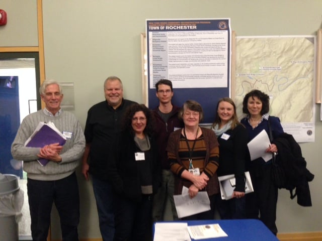 Riverkeeper partners with the Town of Rochester Environmental Conservation Commission to sample locations in and around Accord, and with the Town of Wawarsing Environmental Conservation Commission to sample locations upstream of there. In other parts of the watershed, Riverkeeper coordinates concerned citizens.
-
Waterway Classifications
Middle Rondout Creek (portion 4, from Rondout Reservoir to Honk Lake) is designated class C(TS), meaning that water quality must support fisheries and non-contact recreation. The ‘TS’ indicates that this section of the waterway is trout spawning habitat. In this section of the waterway, citizen scientists test the water at Wawarsing- Below Rondout Res fishing access.
Middle Rondout Creek (portion 2, from Honk Lake to Wawarsing) is designated class C(T), meaning that water quality must support fisheries and non-contact recreation. The ‘T’ indicates that this section of the waterway is habitat for trout. In this section of the waterway, Riverkeeper’s citizen science partners test the water at:
- Napanoch- Route 209
- Napanoch- State Prison
- Wawarsing- Port Ben Road
Middle Rondout Creek (portion 1, from Wawarsing to Wallkill River) is designated class B, meaning that water quality must support primary and secondary contact recreation and fishing. In this reach of the waterway, sampling partners test at:
- Wawarsing- Foordemoore Road Bridge
- Kerhonkson- Route 44/55 Bridge
- Kerhonkson- 42nd Street Bridge
- Accord- Route 209 & River Street
- Alligerville- Route 6 Bridge swimming hole
- High Falls swimming hole
- Rosendale- AJ Snyder Field
- Rosendale- Rosendale Trestle
- Tillson- NY Thruway Crossing
- Rondout- Creek Locks fishing access
Lower Rondout River (from Eddyville Dam to mouth) is designated class C, meaning that water quality must support fisheries and non-contact recreation. In this section of the waterway, Riverkeepers Boat Captain tests the water at Eddyville Anchorage.
Rondout Creek’s tributaries are classified separately from the main stem.
- Rochester Creek is designated class A(TS), meaning that water quality must support use as drinking water. The ‘TS’ indicates that this section of the stream is trout spawning habitat. This tributary is tested at Accord.
- Beer Kill is designated class B(TS), meaning that water quality should support primary and secondary contact recreation and fishing. The ‘TS’ indicates that this section of the waterway is trout spawning habitat. Riverkeeper’s sampling partners test the Beer Kill at Ellenville.
- Lower Sandburg Creek (from Spring Glen to mouth) is designated class B(T). meaning that water quality should support primary and secondary contact recreation and fishing. The ‘T’ indicates that this section of the waterway is habitat for trout. Citizen scientists sample this tributary at Ellenville.
-
Water Quality Data and Impairments
NYSDEC’s most recent biomonitoring results indicated that wastewater treatment plant discharges in Ellenville and Napanoch cause water quality to decline in Wawarsing compared to conditions just upstream. However, the observed impacts were not severe enough for this section of the stream to be categorized as impacted, and the stream appeared to recover further downstream.
Hudson Basin River Watch’s 2007 Rondout River Watershed report card, also based on macroinvertebrate biomonitoring, also noted slight water quality impacts attributable to these wastewater treatment plant discharges. The report also documented slight, but consistent, nutrient enrichment impacts from Sandburg Creek to Rochester. Sites downstream of Rochester were not evaluated in the report card.
Water Quality Data Sources
Hudson Basin River Watch Watershed Report Card, 2007
NYS DEC Waterbody Inventory for Rondout River Watershed, 2007
Friends of the Rondout/Hudson Basin River Watch Assessment of the Roundout Creek at the Snyder Field in the Town of Rosendale, 2002The Hudson Valley Natural Resource Mapper is an online geographic information system which enables the user to view pertinent environmental information related to the health of the Hudson River watershed. It also includes information from the New York State Department of Environmental Conservation’s biomonitoring points, where they sample macroinvertebrates to determine a waterbody’s quality and to assess human impacts.
-
Wastewater Infrastructure
Currently not info.